The Islands of Riung, One by One: Ontoloe, Rutong, Tiga and the Rest
Riung Flores Editorial Desk 11 min read
Official and tourism-agency listings name well over seventeen islets in the Riung marine park — Wire, Sui, Taor, Tembaga, Tiga (Panjang), Bampa, Meja, Rutong, Patta, Halima (Nani), Besar, Lainjawa, Dua, Ontoloe (Ontole) with its Kalong flying-fox roost, Borong and Pau among them — but a standard boat day only visits three to five. Spelling varies across sources, and this page uses the documented variants rather than forcing one “correct” version.
Why does this matter beyond trivia? Because most travel write-ups about Riung describe “the 17 Islands” as a single undifferentiated attraction, when in fact the islands vary enormously in size, role, and what you can actually do at each one — some are landing stops, some are sail-past sights, some are reef markers with no documented tourist activity at all. Knowing which is which lets you set expectations for your boat day and ask your skipper for the stops that actually match what you want (a reef, a beach, a wildlife sighting) rather than a generic “island hopping” promise.
| Island | Documented role | Typically visited on a day boat? |
|---|---|---|
| Ontoloe / Ontole | Largest island, flagship landmark | Yes — common beach/landing stop |
| Kalong / Kelelawar | Fruit-bat (flying fox) roosting site | Sail-past, timing-dependent |
| Bampa | Primary documented reef, clearest water | Yes — main snorkeling stop |
| Rutong / Rotong | Confirmed park island, beach/swim stop | Often |
| Meja | Named park island, secondary stop | Sometimes |
| Tiga / Panjang | Named park island, secondary stop | Sometimes |
| Wire, Sui, Taor, Tembaga, Patta, Halima/Nani, Besar, Lainjawa, Dua, Borong, Pau | Named in official listings, part of the wider group | Rarely, if at all, on a standard day |
Pulau Ontoloe (Ontole)
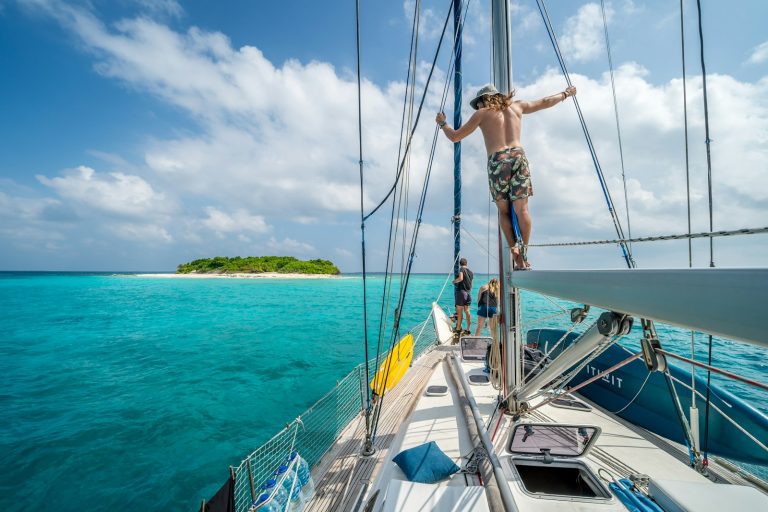
The largest island in the group and its de facto namesake landmark. Most day-boat routes include a stop here, typically for a beach walk rather than for a specific documented reef. Because of its size, it is the island most likely to appear in wide establishing shots of “the 17 Islands” in tourism photography, even though the smaller reef islands like Bampa are where the actual snorkeling happens.
Pulau Kalong (Kelelawar)
Named for its role as a fruit-bat (flying fox) roosting site among its mangrove trees. Boats typically sail past rather than land, ideally timed for late afternoon when the colony takes flight to feed — see our photo spots guide for how to time this into a shoot.
Pulau Bampa
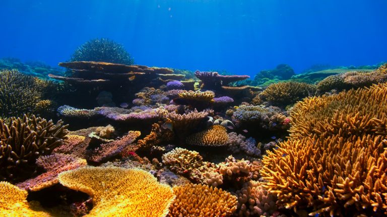
The reef most consistently singled out by specialist trip guides for clear water, healthy hard coral, and reef fish, especially on calm dry-season mornings — full detail on our snorkeling spots guide.
Pulau Rutong (Rotong)
Confirmed by local Flores news coverage as part of the marine park’s documented island set. Commonly rotated into a day’s route as a beach or swimming stop.
Pulau Meja and Pulau Tiga (Panjang)
Both appear in official tourism listings of the park’s named islands and are used interchangeably with Rutong as secondary beach/swimming stops, depending on the captain’s route that day and sea conditions.
The eleven smaller islands that rarely make an itinerary
These islets appear in an official-style Kemenparekraf/tourism-agency listing of the park’s named islands but are not commonly described in trip reports as regular boat-day stops. Their presence on the official list is part of why the park’s real island count runs well past seventeen — and part of why Indonesian tourism media consistently describe the “17” in the park’s name as a reference to 17 August, Indonesian Independence Day, rather than a literal current tally. Our tickets and permits page covers this naming question with full sourcing.
Why a standard boat only visits three to five of these
No official stop sequence is published; captains choose a route based on group size, weather, and how much of the day is left after the entrance and boat-rental negotiation at the harbour. Bampa (for snorkeling), Ontoloe (as the flagship stop), Kalong (for the bat colony, timing permitting), and one or two of Rutong/Meja/Tiga make up the realistic day described on our boat tour page. A single-day charter simply doesn’t have the hours to reach every named islet in the group, especially the smaller, further-out ones that appear on official lists but rarely in trip reports — reaching those would likely require a private, multi-day charter rather than the standard shared day-boat itinerary.
How this affects what you should ask for when booking
If a specific island matters to you — say, you specifically want the Bampa reef, or you specifically want to time Kalong for the evening bat flight — say so explicitly when negotiating your boat at Riung harbour rather than assuming a generic “17 Islands tour” will automatically include it. Because there is no fixed, published itinerary, the stops you get are the stops you negotiate. This is also why two travelers’ accounts of “the Riung boat tour” can describe quite different days — they may have visited a different subset of these islands entirely.
How island names appear across sources
Spelling and transliteration vary meaningfully across Indonesian government pages, provincial tourism material, and independent travel writing — Ontoloe/Ontole, Rutong/Rotong, and Tiga/Panjang are the most common pairs of variant spellings you’ll see for the same island. Rather than pick one spelling and imply the others are wrong, this page presents the documented variants as they actually appear across official and tourism-agency sources, which is also the more useful approach if you’re cross-referencing this guide against a map, a boat operator’s verbal description, or another article that happens to use a different spelling.
Frequently asked questions
Which island in the group is the largest?
Pulau Ontoloe (Ontole).
Are all seventeen-plus islands open to visitors?
We have not found evidence of formal access restrictions naming specific islands as off-limits, but in practice most visitors only ever set foot on or snorkel near the handful of islands a standard day boat actually stops at.
Why do island name spellings vary between sources?
Local place names in this part of Flores are transliterated inconsistently across Indonesian and English-language sources — this page uses the documented variants rather than forcing a single spelling where sources disagree.
Detailed exploration of Riung’s individual islands, from Ontoloe to Tiga and beyond, necessitates a dedicated boat with an experienced crew to navigate the reefs and channels. This allows for comprehensive access to each unique location. Komodo Luxury offers island exploration tours and multi-day sailing voyages across Flores, adaptable for Riung. Browse their available vessels to begin planning your island-by-island adventure.
For a closer look at one specific island profile as a reference point, this Kanawa Island guide (a sister publication in the same independent-guide network as this site) shows how a single-island writeup in the region is typically structured.
The lesser‑known islands and how to think about them
Beyond Ontoloe, Bampa, Rutong, Meja and Tiga, the marine park’s maps list a scatter of much smaller or less‑visited islets: Wire, Sui, Taor, Tembaga, Patta, Halima (Nani), Besar, Lainjawa, Dua, Borong and Pau. These names almost never appear in short trip reports, which is why visitors are often unsure how to ask about them once they are already on the boat.
The key point is scale and function. Some of these islets are little more than sand and rock outcrops that help define channels and sheltered water, such as Wire, Sui and Taor. Others — Tembaga, Patta, Halima and Lainjawa — are larger and vegetated, but do not yet have a clearly documented role as standard landing or snorkeling stops.
If you want to deviate from the three‑to‑five‑stop template most skippers follow, speak in terms of what you want to do rather than reciting a list of names. Combine this page with the outline in the Riung 17 Islands day trip guide so you can talk concretely about extra snorkel time, a quieter beach, or later‑day positioning for photography instead of chasing an abstract count of islets.
Can I ask my skipper to land on tiny islands like Dua, Pau or Borong?
In calm, mid‑tide conditions, some skippers may agree to drop you on a small sand‑fringed islet such as Dua or Pau for a short beach break or photos. There are no facilities or shade, and surf or swell can make landings unsafe, especially in the wet season. Treat any such visit as opportunistic, and let the skipper overrule your request if wind or current are marginal.
Why do some maps carry island names you cannot find anywhere else?
Locally produced or older maps sometimes carry labels that appear in no government listing and never reach tourism brochures. Where a name is not in a documented list, this site does not repeat it: treat it as a minor rock or an internal navigation reference until a skipper or the park office confirms otherwise. The “17” in the park name is symbolic, so cartographers sometimes group features differently. For visitors, these extra names matter less than clarifying what activities you want to prioritise during limited time on the water.
Is there anything specific to see on Rutong beyond a swim stop?
Rutong is mostly used as a quiet swim and sand‑walk stop when Bampa feels crowded or choppy. There is no formal trail infrastructure, but some crews refer informally to a short scramble to a low ridge as a viewpoint for photos back toward Ontoloe and the boat anchorage. Footwear helps, as the ground is dry and uneven. Do not expect shade, kiosks or freshwater here.
How different is Pulau Tiga from Meja or Panjang in practice?
Meja and Pulau Tiga (labelled Panjang on some charts) function interchangeably for most visitors. Skippers may pick one or the other for a final snorkel or a sandbar walk, depending on wind, swell, and how many boats are already anchored. None has jetty infrastructure or stalls. If you care about a particular angle for photography, discuss this before leaving the harbour rather than mid‑day.
Can I design an itinerary that focuses on quieter, unnamed‑in‑blogs islands?
You can ask to reduce time at the classic combination of Bampa, Rutong and Ontoloe in favour of circling near Wire, Sui, Taor or Lainjawa in search of solitude, but you are trading ease of landing and known reefs for exploration. For a fuller picture of how skippers think about routes, read the Indonesian‑language notes in the local boat charter overview before you arrive.
Are there mangroves or wildlife around these peripheral islets worth planning around?
Several of the lesser‑discussed islands carry mangrove fringe or scrub that matters ecologically more than scenically. For structured wildlife viewing, such as the evening flying‑fox lift‑off, your time is usually better focused around Ontoloe and its channels rather than, say, Halima or Patta. The dedicated Riung mangrove tour guide explains how boats weave in and out of these margins on longer, nature‑focused days.
Do any of these secondary islands involve Komodo dragons or large lizards?
Monitor lizards are occasionally reported on the drier, larger landmasses in the group, including Ontoloe and, anecdotally, parts of Rutong and nearby islets. None of these provide the managed, high‑probability Komodo dragon experience associated with Komodo National Park. If dragons are central to your trip planning, read the clarification in the article on dragon sightings around Ontoloe and Rutong and plan a separate Komodo leg rather than relying on Riung alone.
Once you have used this island‑by‑island guide to decide how much time you want on Ontoloe, Bampa or the outlying rocks, the next decision is whether Riung is your only boat day or a prelude to a Komodo leg. For structured sailing with cabins, look at a private Komodo charter, combine Riung with a 3D2N circuit, or extend further with a longer luxury cruise Indonesia itinerary.
Keep reading
Uncategorized 11 min
Riung 17 Islands: What Changed for 2027
What's changed for Riung travel planning, most recent update first: a magnitude 7.7 earthquake struck north Flores on 15 August…
Uncategorized 11 min
Riung 17 Islands Solo Travel: Joining a Shared Boat
Riung 17 Islands as a solo traveller: the most cost-effective route is joining an existing group's shared boat rather than…
Uncategorized 11 min
Can You Dive at Riung 17 Islands?
Can you dive at Riung 17 Islands? No - there is no PADI dive centre or scuba operation based in…